Antenna height
When using a GNSS receiver, the position is computed at the Antenna Phase Center (APC), not at the ground point. The APC is the electrical point inside the antenna dome where the GNSS signal is effectively measured.
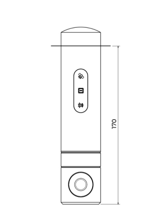
The Antenna Reference Point (ARP) is the physical reference point on the receiver — on the GEOSTIX, this is the base of the 5/8” thread mount. The vertical distance between the ARP and the APC is a fixed offset specific to each receiver model.
If the GEOSTIX is mounted on a surveying pole, you must enter the total distance from the ground to the APC so the app can compute the correct ground-level elevation.
ARP to APC offset
Section titled “ARP to APC offset”On the GEOSTIX, the APC is located 0.17 m (170 mm) above the ARP. This offset must be included when entering the antenna height.
For example, if your surveying pole is 2.00 m tall (from ground to the base socket), the total antenna height to enter in the app is:
2.00 m + 0.17 m = 2.17 m
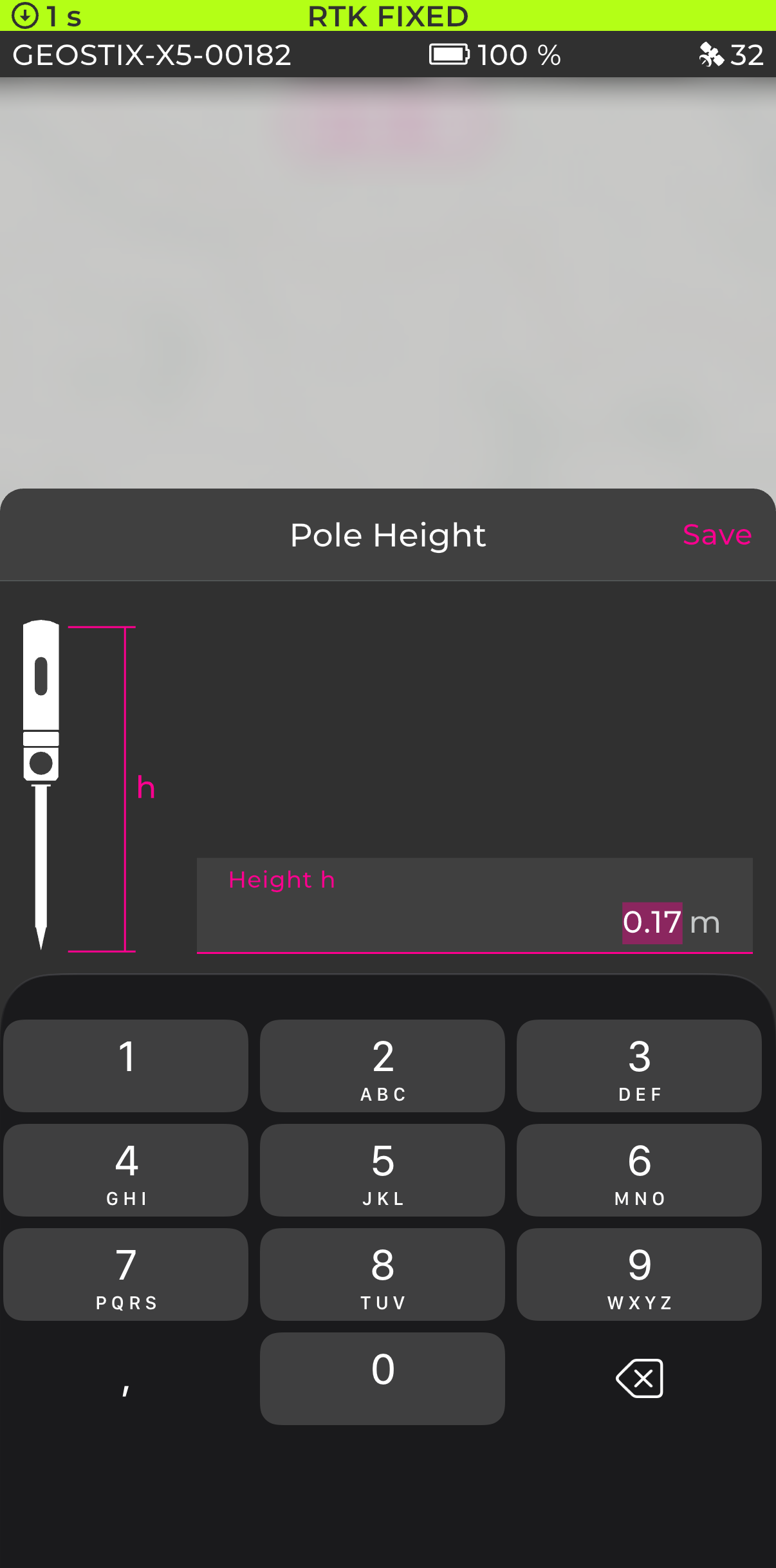
Setting the antenna height in the app
Section titled “Setting the antenna height in the app”On the main page (map view), tap the antenna height button at the bottom right of the screen.
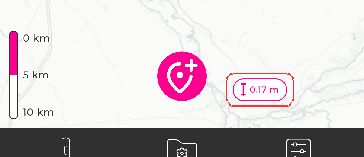
A dialog opens where you can enter the total height h from the ground to the antenna phase center (pole height + 0.17 m) in meters, then tap Save.