

Description
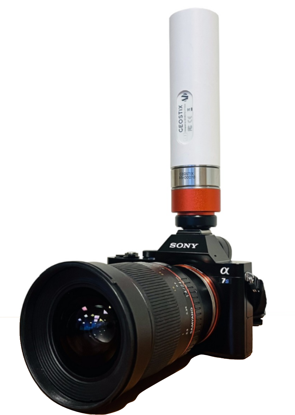
The Hotshoe/flash sync layer allows the GEOSTIX to record both the exact timestamp of the photo and its precise position as well as the orientation of the camera-GEOSTIX system in space.
This layer is designed to be mounted on the hotshoe of any camera equipped with a standard flash socket.
How it works
Section titled “How it works”Each photo taken by the camera sends a pulse — or more precisely, a brief low signal (GND).
The GEOSTIX equipped with the layer hotshoe captures this signal and records:
- the exact time with sub-microsecond accuracy,
- the position,
- the orientation provided by the GEOSTIX’s IMU.
The data is saved onto the microSD card located under the GEOSTIX and accessible via USB connection.
The log file is named EXTEVENT.LOG and contains several fields described below:
| Variable Name | Description |
|---|---|
| TimeOfWeek | GPS time of week, starts Sunday at 00:00:00.00 convert |
| WeekNumber | GPS week number convert |
| FixStatus | ”R” => RTK FIX / “F” => RTK FLOAT / “S” => SINGLE / “D” => DGNSS / “N” => NO FIX |
| Lat | Latitude (°) |
| Lon | Longitude (°) |
| Height | Height above ellipsoid (m) |
| HAccuracy | Horizontal accuracy |
| VAccuracy | Vertical accuracy |
| OrientationX | |
| OrientationY | |
| OrientationZ | |
| Support1 | Debug info |
| Support2 | Debug info |
222708.445229,2285,"R",45.519933813,6.680457525,1738.724,0.04,0.05,0.3585647,-0.0514448,0.1724559,0,0222716.363965,2285,"R",45.519925443,6.680454741,1738.727,0.04,0.05,0.3569530,-0.0224424,0.1067406,0,0222721.165234,2285,"R",45.519917662,6.680453892,1738.713,0.05,0.07,0.3663970,-0.0107033,0.0703658,0,0| MECHANICAL | |
| Height to account for (layer) | TBD |
| Weight | 40 g |
| POWER CONSUMPTION | |
| In operation | 0 (mW) |